Outdoor Gear & Adventure Essentials: Hiking Shoes, Surfboards, Climbing Ropes, & Survival Kits
Outdoor Gear & Adventure Essentials: Hiking Shoes, Surfboards, Climbing Ropes, & Survival Kits Outdoor Gear & Adventure Essentials: Hiking Shoes, Surfboards, Climbing Ropes, & Survival Kits
Cart(0)
Home outdoor equipment Navigation and communication equipment
Indiana Counties Wall Map
  • 26x36
  • Paper

$ 0.00

$ 92.95

Please select combo product attributes
The combo subtotal is $,SAVE$
Unavailable

Product Details

The Indiana Counties Wall Map by Maps.com is perfect for when you need a US state county map that's clear, concise and up-to-date. Perfect for home, business and classrooms, this highway map has just the right amount of counties, cities, roads and geographic features. Created using GIS data, this map is aesthetic and a great tool for locating sales territories and for general reference. The Counties are alternately color coded making them easy to identify.

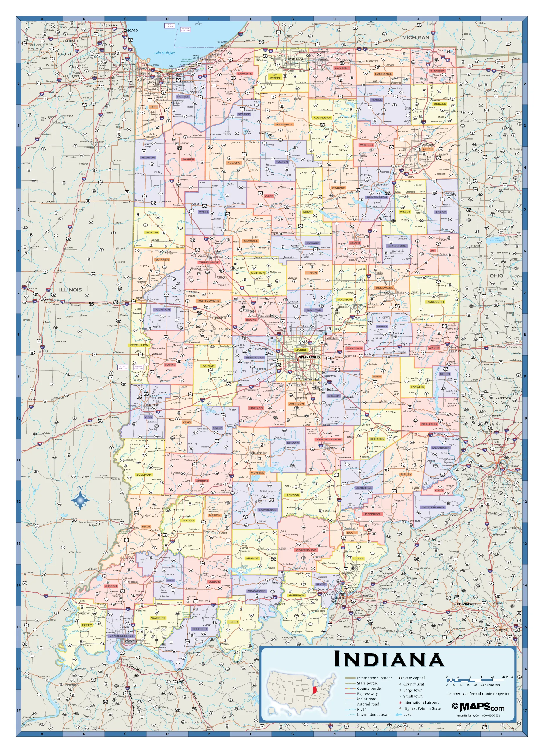
Data included on this Indiana Counties Highway Map:
• International and State Borders
• County Names and Borders
• Large and Small Cities*
• Highways and Freeways
• Arterial Roads
• Time Zones
• Lakes, Rivers, Dams
• Mountain Ranges, Deserts, Islands
• Highest Point
• Wilderness Areas
• International Airports
• Military Bases
• National Parks
• Counties alternately shaded
• Cities are indexed separately in a PDF that is printed and shipped with the map
•

*Large cities refers to 10,000 or more residents. Small cities refers to fewer than 10,000 residents.
The Indiana Counties Wall Map by Maps.com is perfect for when you need a US state county map that's clear, concise and up-to-date. Perfect for home, business and classrooms, this highway map has just the right amount of counties, cities, roads and geographic features.

You May Also Like
Cart
Outdoor Gear & Adventure Essentials: Hiking Shoes, Surfboards, Climbing Ropes, & Survival Kits
Your cart is currently empty.